Utah Earthquake Program
The Utah Earthquake Program is a strong partnership that unites diverse professionals working cooperatively to reduce earthquake losses and risk in Utah. The Utah Seismic Safety Commission and three closely intertwined Utah state agencies—the University of Utah Seismograph Stations (UUSS), the Utah Division of Emergency Management (UDEM), and the Utah Geological Survey (UGS)—are the public face of the program. Professional organizations actively partnering in the program include the Utah Chapter of the Earthquake Engineering Research Institute (EERI), the Utah Section of the American Society of Civil Engineers (ASCE), the Intermountain Section of the Association of Environmental and Engineering Geologists (AEG), and the Structural Engineers Association of Utah (SEAU).
By bringing together professionals with emergency management, engineering, geology, seismology, and public outreach expertise into a collaborative framework, the Utah Earthquake Program leverages a broad array of experience, reduces duplication of effort, optimizes limited funding, and ensures the delivery of consistent, authoritative earthquake-related information for the benefit of all Utahns.
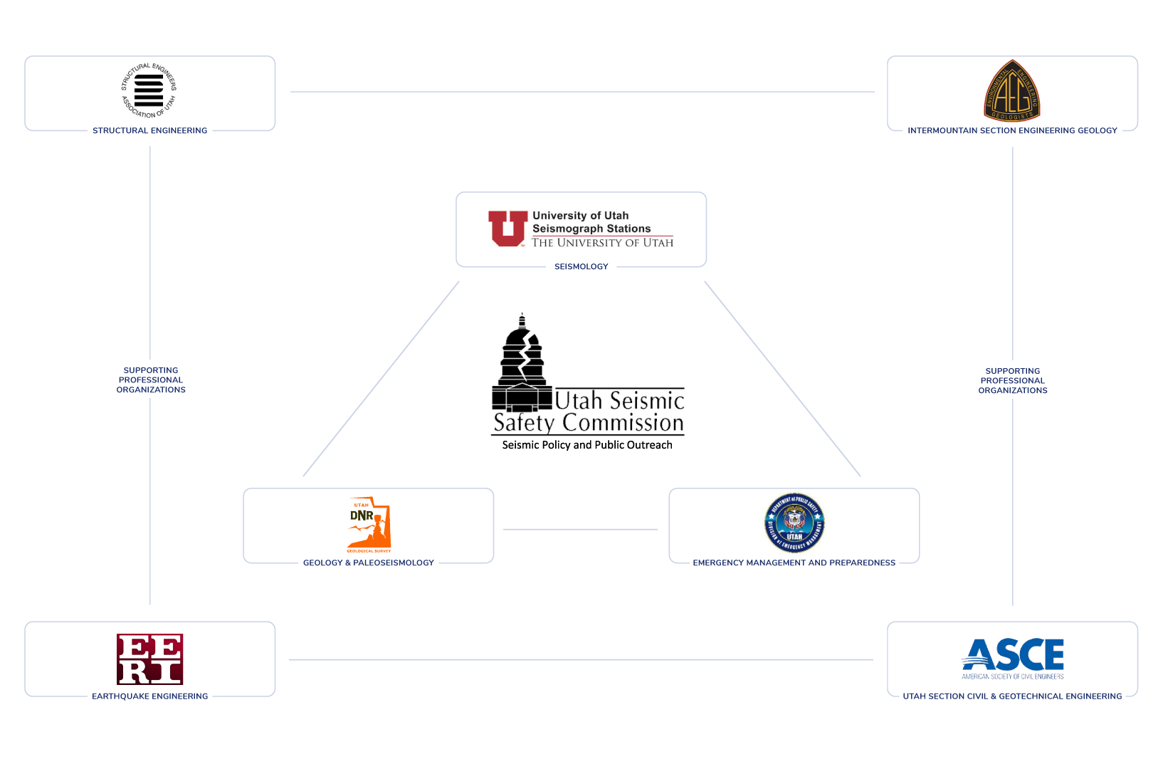
The Utah Earthquake Program facilitates effective partnering between the State of Utah and the National Earthquake Hazards Reduction Program (NEHRP) through its constituent federal agencies: the Federal Emergency Management Agency (FEMA), the National Institute of Standards and Technology (NIST), the National Science Foundation (NSF), and the U.S. Geological Survey (USGS).